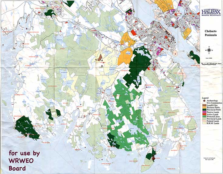
The Map
View in Web Browser
At right: 734x573 px(84 KB)
1101x859 px
(180 KB)
1467x1145 px
(312 KB)
2201x1718 px
(648 KB)
2934x2290 px
(1 MB)
4401x3434 px
(2 MB)
View in a PDF
Largest size as a PDF (2 MB)Some browers (e.g., Firefox) may automatically resize the web version to fit on the screen. Use the zoom function (usually under under "View:" in the top menu) to view the image at full size. The PDF version is the largest size; use the zoom function in Acrobat to see the map at different sizes.
