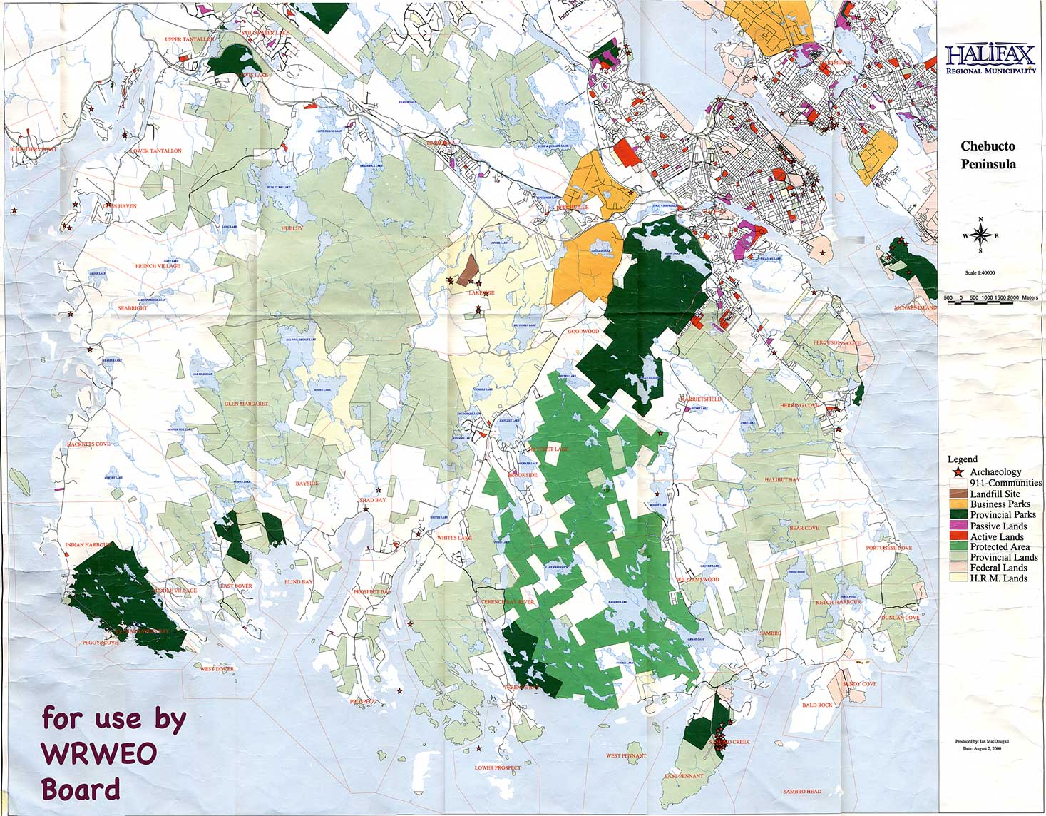
The Map
View in Web Browser
734x573 px (84 KB)1101x859px (180 KB)
At right: 1467x1145 px
(312 KB)
2201x1718 px
(648 KB)
2934x2290 px
(1 MB)
4401x3434 px
(2 MB)
View in a PDF
Largest size as a PDF (2 MB)| This is the large map showing land use in western HRM (Chebucto Peninsula) that we frequently make use of at WRWEO board meetings, It can be viewed in a web browser at different sizes (select a size at left), or downloaded as a PDF document (bottom link at left). Please do not distribute this version beyond the board. Thanks. Some browers (e.g., Firefox) may automatically resize the web version to fit on the screen. Use the zoom function (usually under under "View:" in the top menu) to view the image at full size. The PDF version is the largest size; use the zoom function in Acrobat to see the map at different sizes. |